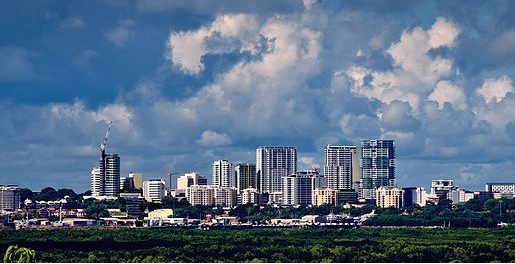
Darwin Skyline. Credit: Jeremy De Guzman, Wikimedia Commons.

EXPERT REACTION: Darwin city centre evacuated after 7.2 magnitude earthquake

Embargoed until: Publicly released:
It has just been reported that a 7.2 magnitude earthquake has occurred off the coast of Darwin. The Bureau of Meteorology says there is no tsunami threat from the earthquake, which occurred at a depth of 207km in the Banda Sea, north of Australia

Organisation/s: The University of Melbourne, Curtin University, Griffith University, University of Technology Sydney (UTS), The University of Newcastle

Expert Reaction

These comments have been collated by the Science Media Centre to provide a variety of expert perspectives on this issue. Feel free to use these quotes in your stories. Views expressed are the personal opinions of the experts named. They do not represent the views of the SMC or any other organisation unless specifically stated.

Associate Professor Karine Dupre is the Program Director (Bachelor) at Griffith Architecture & Design, Griffith University

When the earthquake shook Darwin today, more than one person certainly remembers when cyclone Tracy devastated the city at Christmas 1974. With no immediate reports of major damage or injury to date, perhaps all the measures and policies that were implemented in Tracy’s aftermath are paying off today. Although cyclones and earthquakes do not affect buildings in the same way, some of the construction techniques to improve resistance may be the same.

With the ‘Cyclone Code’ Building Regulations that came into effect in late 1974, many buildings were constructed to ‘sit out’ the cyclone, which included stiffness and strength, good foundations, good distribution of the load of the building and capacity to have a plan B (remember the reinforced bathroom to act as a private bunker?). Those five latter elements are often invoked whilst designing earthquake-resistant building.

The Museum and Art Gallery of the Northern Territory has a great exhibition on the cyclones that devastated the city and the successive recoveries. Maybe it is now time to add an earthquake section?

Last updated: 25 Jun 2019 2:37pm
Declared conflicts of interest:
None declared.
Dr Behzad Fatahi is Professor of Civil Engineering at the University of Technology Sydney

At 02:53 (UTC) on 24 June 2019, a magnitude 7.3 earthquake at depth of 208km occurred 350km northeast of Lospalos in East Timor (population of 1.2 million) in Banda sea, with the epicentre being about 720km away from Darwin city in the north of Australia.

Indeed, historically the region, where Australian and Sunda tectonic plates meet, have been seismically very active. Near the location of this earthquake, Sunda and Australian plates are converging at a rate of approximately 76 mm/yr, and the earthquake appears to be within the subducted Australian plate. Due to this intermediate depth earthquake, peak ground acceleration in the range of 0.30g and peak ground velocity of 30 cm/s are expected.

Since in this earthquake the type of movement between tectonic plates is likely to be strike-slip (blocks slide past each other), significant tsunamis would not be expected.

Due to the intermediate depth of this earthquake, it is expected that the earthquake would be felt at far distances, while the devastating effects of the earthquake near the epicentre would not be so significant due to earthquake damping while passing through ground layers.

It is expected that mid-rise and tall buildings will experience notable lateral movements and vibration, however due to the depth of the earthquake and its location, damage to building would not be expected at far distances. The length of fault rupture in this earthquake is estimated to be 50 km.

Temporary excavations, particularly near existing structures and vibration sensitive structures, must be checked to ensure excessive movements have not occurred. In addition, it is likely that aftershocks would occur, which would be mainly noticeable in Banda and Celebs seas regions.

Last updated: 24 Jun 2019 4:17pm
Declared conflicts of interest:
None declared.
Dr Ifte Ahmed is a Senior Lecturer in Construction Management/Disaster Resilience at the University of Newcastle

Unlike hydrometeorological hazards such as cyclones and floods, geological hazards cannot be forecasted, hence actions can be taken only after an event has occurred.

In the case of the recent earthquake in Darwin on 24th June 2019, people were efficiently evacuated from buildings in Darwin CBD soon after the tremors occurred, and fortunately there was no human casualty or injury, and only one building (Health House) was deemed unsafe and restricted for occupancy.

The Bureau of Meteorology confirmed that there was no tsunami threat. So in this instance, the disaster had very little impact, other than the panic it generated. However, Darwin is close to the notorious “Ring of Fire” where intense seismic activity occurs, which includes the Sunda fault, a band of area in the sea north of Australia.

Darwin experiences seismic tremors on a regular basis, and even though no significant impact has occurred so far, it is definitely at risk from catastrophic earthquakes. Its coastal location also poses a risk from tsunamis generated by earthquakes in this seismically active zone. Therefore, resilience measures for both earthquakes and tsunamis should be a priority for Darwin, including preparedness, response and recovery plans.

A thorough review of building codes, coastal land-use planning and assessment of existing buildings and infrastructure are required, together with augmented ‘soft’ measures such as public awareness, training and evacuation drills.

Last updated: 24 Jun 2019 4:10pm
Declared conflicts of interest:
None declared.
Professor Chris Elders is an expert in plate tectonics and structural geology from Curtin University’s School of Earth and Planetary Sciences.

Another large earthquake has struck Indonesia, and this time it was large enough to be felt in Darwin and other parts of northern Australia.

This particular earthquake was a result of the relentless northward movement of Australia towards SE Asia – it is moving north at about 7.7 cm per year, and part of the tectonic plate on which Australia sits has collided with Timor and Papua New Guinea.  

Ocean crust continues to move down beneath the Banda Sea, and it is this process of subduction that has resulted in this earthquake.

The earthquake occurred at a depth of about 200km, and as the energy spreads upwards and outwards from the point at which it occurs, it will be felt in places as far away as Darwin.

Last updated: 06 Aug 2019 12:17pm
Declared conflicts of interest:
None declared.
Mark Quigley is Associate Professor of Earthquake Science at The University of Melbourne

The deep location (200 km) and steep geometry of the rupture plane suggest this is probably an intra-slab earthquake associated with tearing and differential strike-slip movement of the subducting Australian Plate beneath the Indonesian region.

Such deep, strike-slip events tend not to generate large tsunamis. However, the seismic waves generated from these sorts of earthquakes tend to travel quite efficiently through the Australian Plate, which results in significant shaking in places like Darwin. This is particularly the case for longer period shaking, which tends to most strong affect taller multi-story buildings.

Last updated: 24 Jun 2019 3:13pm
Declared conflicts of interest:
None declared.
Dr Brendan Duffy is a Lead Engineering Geologist at GHD and an Honorary Research Fellow at The University of Melbourne

This seems to be an earthquake in the Australian plate, where it slides under the volcanic arc. The plate is torn and the tear is concentrating stresses in an area east of Timor that has regular earthquakes with magnitude greater than 6. The quake will be felt most strongly in Darwin, compared with for instance Dili, because it is in the lower plate.

Last updated: 24 Jun 2019 3:11pm
Declared conflicts of interest:
None declared.
Paul Somerville is Chief Geoscientist at Risk Frontiers

Both Geoscience Australia and the United States Geological Survey found that the earthquake occurred at a depth of 207 km.  Such deep earthquakes do not generate tsunamis, and no tsunami warning has been issued.

There was quite strong shaking in Darwin, but the earthquake was far enough away that damage would not be expected, and none has been reported to date. 

Parts of the Darwin CBD were evacuated, but I am not aware of any evacuation order and surmise that the long duration of the earthquake shaking caused sufficient alarm to prompt voluntary evacuation.
This shaking is expected to have been most pronounced in the upper floors of the taller buildings in the CBD.

Unfortunately, it appears that we have missed an opportunity to have recorded the ground motions in these buildings. Without such recordings, we can only guess at the level of ground motion that they experienced.

We need recordings so that we are better able to estimate the ground shaking levels that should be used in northern Australia to design buildings and infrastructure to withstand large earthquakes in Indonesia.

Last updated: 24 Jun 2019 3:08pm
Declared conflicts of interest:
None declared.

News for:

Australia
NSW
VIC
QLD
WA
NT

Media contact details for this story are only visible to registered journalists.