
 International
News release
From:
Earth science: Ancient river landscape found beneath East Antarctic Ice Sheet *IMAGE*
An ancient river-carved landscape preserved underneath the East Antarctic Ice Sheet is reported in Nature Communications. Continental-scale ice retreat has not touched this newly discovered landscape for at least 14 million years, but this may change with projected climate warming, the authors suggest.
The Earth’s climate is rapidly changing and is on course to reach temperatures typical of those 34–14 million years ago (between 3–7°C higher than today). Understanding how the Antarctic Ice Sheet changed in the past helps inform how it may evolve in the future owing to ongoing climate change. This is important because the ice sheet currently contains the equivalent of approximately 60 meters of potential sea level rise. Ice-penetrating radar can be used to see the landscape underneath the ice and determine how the ice sheet changed before the satellite era.
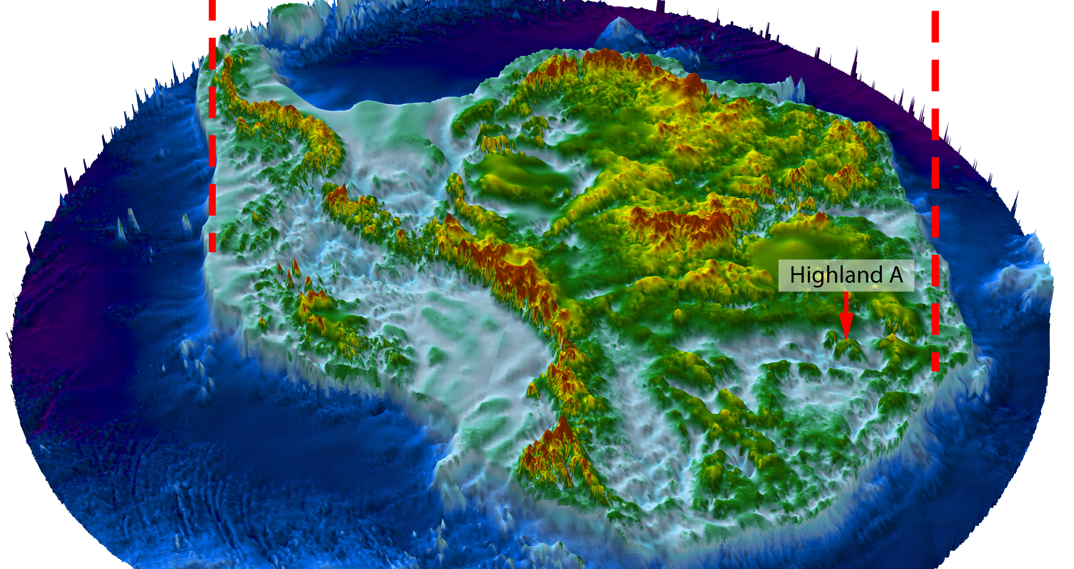
Stewart Jamieson and colleagues used satellites and radar to analyze the landscape underneath the East Antarctic Ice Sheet in the Aurora-Schmidt basins inland of the Denman and Totten glaciers. They found that the landscape consists of three river-carved upland blocks separated by deep troughs, which are only about 350 km from the ice sheet edge. These blocks were shaped prior to glaciation, when rivers crossed the region to a coastline that had opened up during the breakup of the Gondwana supercontinent. The break-up of Gondwana also caused valleys to be formed between the upland blocks, before the uplands became glaciated. The authors suggest that ice over the region then remained largely stable over millions of years despite intervening warm periods.
The authors suggests that climate warming could result in ice retreat into this region for the first time in at least the last 14 million years, and the findings improve our understanding of the past glacial history of the East Antarctic Ice Sheet.
Attachments
Note: Not all attachments are visible to the general public. Research URLs will go live after the embargo ends.


