
 International
News release
From:
Mapping changes in the ionosphere with smartphones
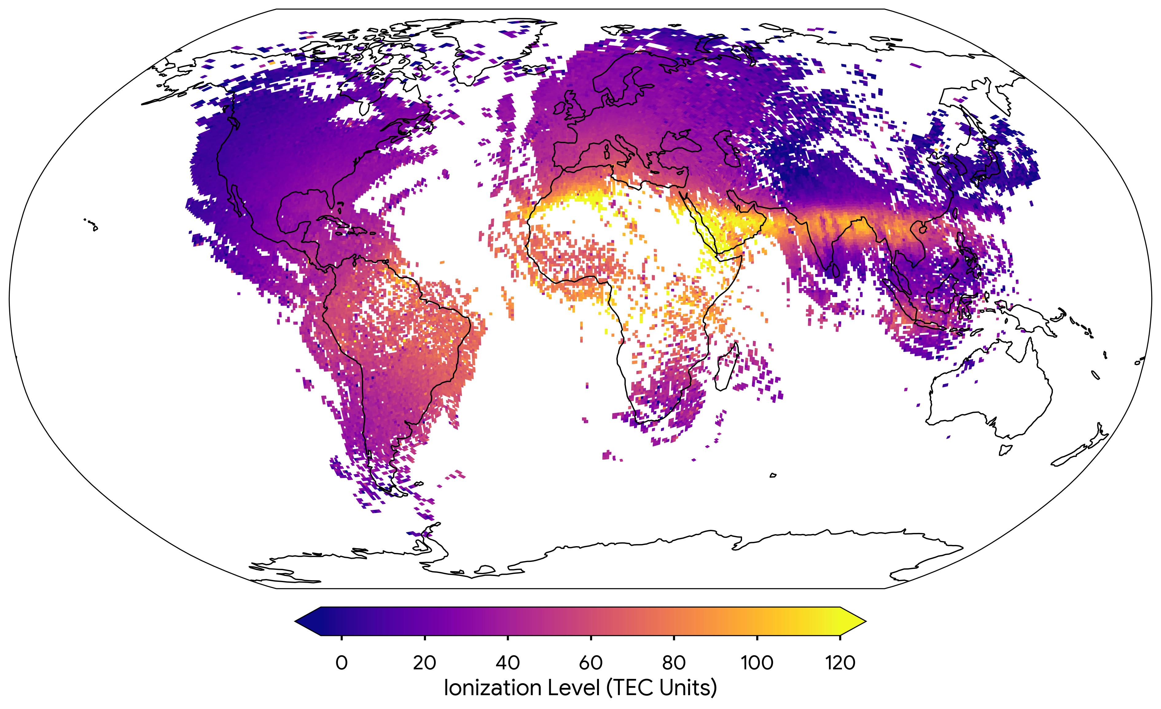
Aggregated measurements from millions of smartphones could be used to create a comprehensive map of the Earth’s ionosphere, leading to better global positioning systems, according to a paper published in Nature.
The ionosphere is the upper portion of Earth’s atmosphere consisting of free electrons, which are influenced by solar winds and geomagnetic storms. Radio waves from satellites to Earth travel at different speeds based on the behaviour of electrons in different areas of the ionosphere, influencing the accuracy of satellites that house Earth’s global positioning systems, for example. Tracking the electron concentration in the ionosphere can help correct for differences in wave speeds, but maps generated with ground-based Global Navigation Satellite System (GNSS) receivers may have gaps.
Brian Williams and colleagues used de-identified measurements from millions of Android smartphones to generate a map of the ionosphere and its dynamic conditions, which is double the coverage of traditional ground-based receivers. Some Android phones feature dual-frequency GNSS receivers which can make the same measurements as the larger ground-based receivers. In comparing ionosphere maps generated by approximately 40 million phones per day to that from 9,000 GNSS receivers across a two-month period in 2023, the authors found that there was a high level of agreement between the maps produced. Williams and colleagues note that although both phones and ground-based receivers are located across the globe, there is greater coverage of phones in Eastern Europe, India, South Asia and parts of South America and Africa, leading to potentially better mapping of the ionosphere over those locations.
The authors acknowledge that a clear limitation is that the technology in Android phones is much smaller and less sophisticated than GNSS ground-based arrays, which can increase the amount of measurement noise.
Multimedia
Attachments
Note: Not all attachments are visible to the general public. Research URLs will go live after the embargo ends.


