
 Australia; International; NSW
News release
From:
Unearthing the ancient Nile:
How a lost branch of the Nile River shaped Egypt’s history
Feature by Fran Molloy at Macquarie University
STANDFIRST:
Associate Professor Tim Ralph from Macquarie’s School of Natural Sciences was part of an international team who mapped a long-lost branch of the Nile River that influenced the location and construction of ancient Egypt's pyramids.
An international research team has found evidence of a long-lost branch of the Nile River that influenced the location and construction of several of ancient Egypt’s pyramids and was possibly the main part of the river during much of the country’s early civilisation.
The findings, published in the journal Communications Earth & Environment, shed new light on how the landscape of the Nile Valley evolved over past millennia and its impact on early Egyptian civilisation, including decisions about where to site pyramid complexes.
“The positioning of the pyramids along this extinct watercourse was far from coincidental,” says Associate Professor Tim Ralph from the School of Natural Sciences at Macquarie University, a co-author on the study.
The collaborative study involved researchers from the University of North Carolina Wilmington (USA), the University of Memphis (USA), the University of Chicago (USA), the National Research Institute of Astronomy and Geophysics (Egypt) and Tanta University (Egypt).
Using a combination of radar satellite imagery, geophysical surveying techniques and sediment coring, the researchers mapped the former course of a major tributary of the Nile, the Ahramat Branch, running between two and 10 kilometres west of today’s Nile.
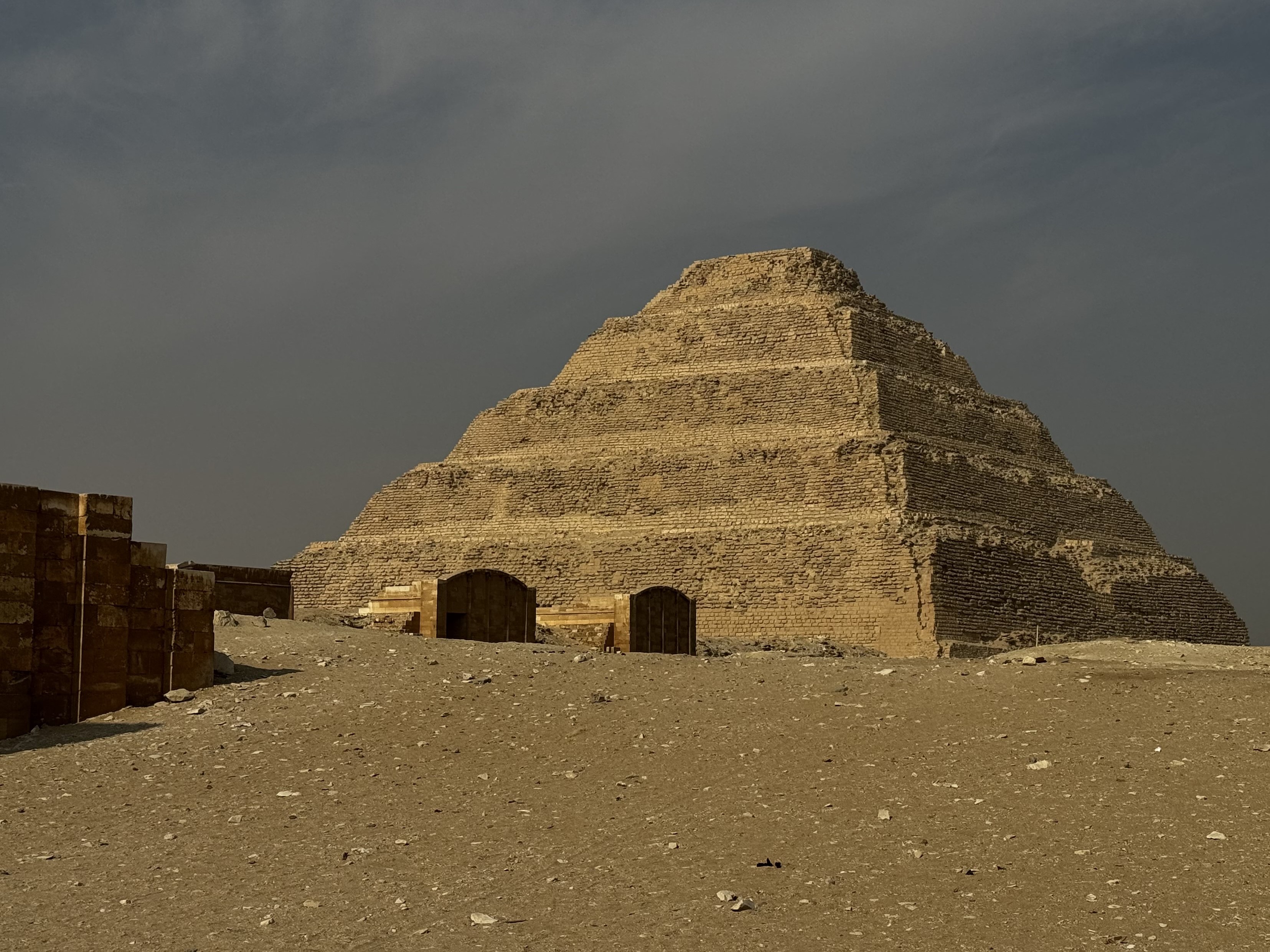
This ancient waterway flowed along the edge of the Western Desert Plateau, passing by the Giza Plateau and Saqqara areas, where many of Egypt’s best-known pyramids are concentrated.
Many scholars have researched the ancient Nile, Associate Professor Ralph says, but this research delivers the first comprehensive map and understanding of the waterways that once fed the extensive pyramid chain from Lisht to Giza.
Imprint on history
“Many pyramid complexes from the Old and Middle Kingdom periods had causeways leading directly to the banks of the Nile’s Ahramat Branch, for easy access to the pyramid sites,” Associate Professor Ralph says.
The new evidence suggests the Ahramat Branch was an active and navigable river during the height of pyramid building in the Old Kingdom and may even have been the main course of the Nile before a changing climate and shifting landscape caused it to dry up and be gradually buried.
But its imprint on ancient Egyptian history had already been made.
“The Ahramat Branch was probably a main artery that brought prosperity to the ancient Egyptians. It was a lifeline in an otherwise dry landscape,” Associate Professor Ralph says.
“Reconstructing this lost waterway helps us better understand the rise of this incredible civilisation.”
Scanning from space
The project began with satellite scans of the landscape to identify the likely location of the former Ahramat Branch beneath the current Nile floodplain. Then, researchers used ground-penetrating radar and electromagnetic scanning to image the buried channel in cross-section, confirming the outline originally derived from satellite data.
At one of the study sites, the channel measured around 600 metres wide from bank to bank and more than 25 metres deep.
“Finding a channel of this size and volume gives a whole new perspective on how the pyramids were built and resourced with workers and materials,” says Associate Professor Ralph.
Sediment cores up to 10 metres deep from the buried channel show that the deeper layers held coarse sands and gravels, with deposits gradually becoming finer nearer the surface. This shows the channel initially held fast-moving water before its gradual in-filling by river silts and windblown desert sands.
The Ahramat Branch dried up sometime after the Middle Kingdom period, likely due to decreasing floods and increasing aridity in the region. Later pyramid construction in the New Kingdom period then moved closer towards the present centre of the Nile Valley.
Settlement patterns
“As rivers move, people move with them,” Associate Professor Ralph says, adding that the shifting of the Nile River over time would have had major implications for ancient Egypt’s settlements, including the relocation of centres of power and pyramid construction.
“The Nile has been incredibly dynamic over time, so ancient civilisations had to be resilient and adaptable as their environment changed around them.”
“This ‘lost’ Nile branch will give archaeologists a new appreciation of ancient sites that, until now, were being looked for in a different place,” says Associate Professor Ralph.
“It has opened up a host of possibilities and may lead to further discoveries and cultural conservation initiatives in the future.”
The groundbreaking research was led by Professor Eman Ghoneim from the University of North Carolina Wilmington. The majority of the paper’s authors are Egyptian scientists, with Professor Ghoneim herself originally from Egypt.
As a geomorphologist, Associate Professor Ralph studies how landscapes and landforms change over time, and his on-ground field trips in Egypt collecting sediment samples and collaborating with local researchers contribute to the rich history of the ancient civilisation.
“We’re documenting in detail and over a large area, for the first time, how the Nile has shifted and moved around over time,” he says. “We tend to think of rivers as static and eternal, but they are dynamic systems that migrate and evolve, shaping our history and culture as they go.”
END
Multimedia
Attachments
Note: Not all attachments are visible to the general public. Research URLs will go live after the embargo ends.


