
 Australia; International
News release
From:
A groundbreaking international study led by CSIRO, Australia’s national science agency, and the University of California at Berkeley has presented a new map of Earth’s seasonal growth cycles. The map reveals global hotspots of seasonal asynchrony and demonstrates their surprising ecological, evolutionary, and even economic consequences.
Using 20 years of satellite data and a unique analytical approach, the study, published today in Nature, offers the most comprehensive map to date of the phenology, or seasonal timing, of Earth’s terrestrial ecosystems.
Lead author Dr. Drew Terasaki Hart, CSIRO Ecologist and Data Analyst, said that the study identifies hotspots of seasonal asynchrony – regions where nearby sites can show dramatically different seasonal timing.
“Seasonality may often thought of as a simple rhythm – winter, spring, summer, fall – but our work shows that nature’s calendar is far more complex. This is especially true in regions where the shape and timing of the typical local seasonal cycle differs dramatically across the landscape. This can have profound implications for ecology and evolution in these regions."
These hotspots of seasonal asynchrony are predominantly found in Earth’s Mediterranean climate regions and tropical montane regions. The study offers compelling evidence that seasonal asynchrony there can cause different populations of a species to have mismatched reproductive timing.
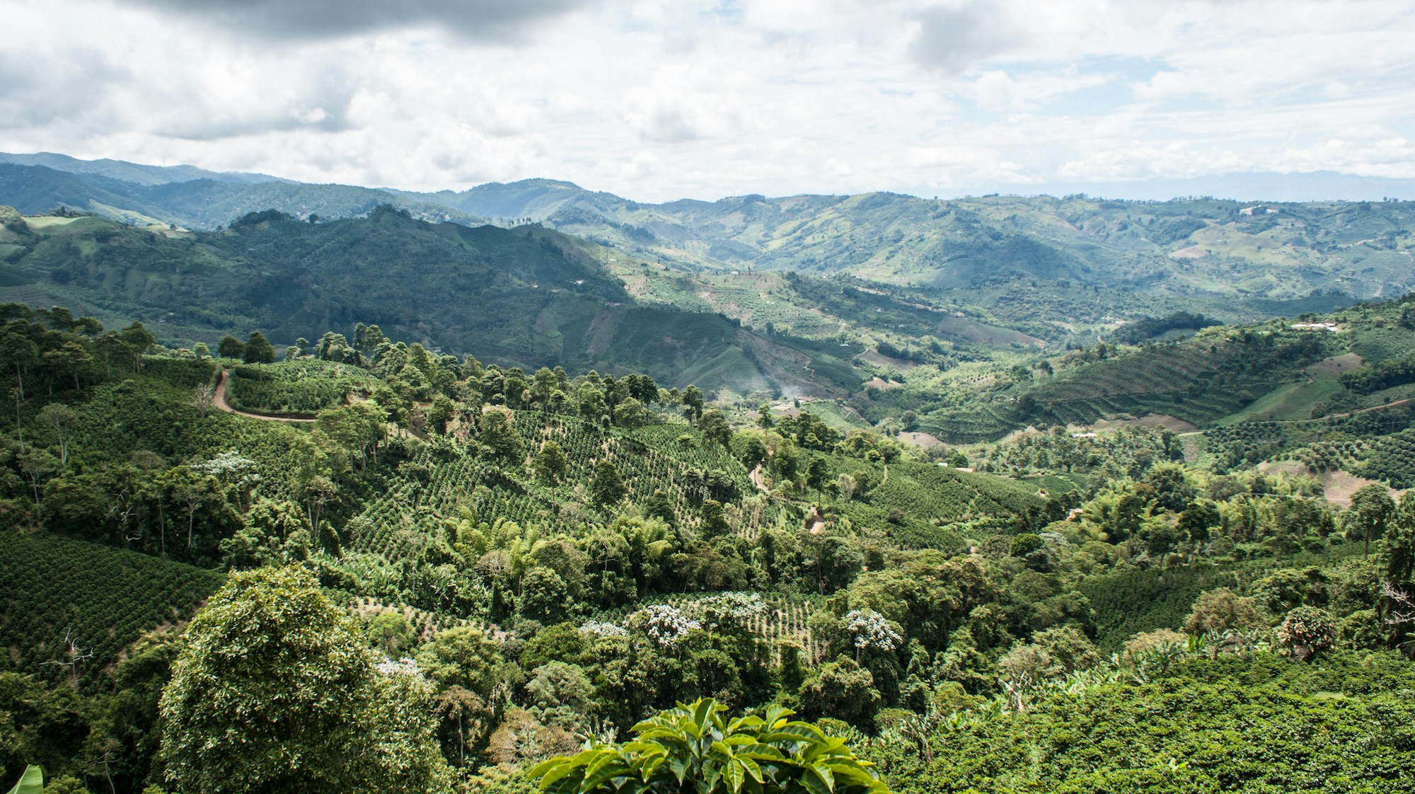
“Our map predicts stark geographic differences in flowering timing and genetic relatedness across a wide variety of plant and animal species. It even explains the complex geography of coffee harvest seasons in Colombia – a nation where coffee farms separated by a day’s drive over the mountains can have reproductive cycles as out of sync as if they were in opposite hemispheres.”
Seasonal asynchrony could accelerate evolutionary divergence between those populations and, after enough time, could even drive them to become distinct species – perhaps helping to explain why these hotspot regions also tend to have exceptional species richness.
The study also highlights the limitations of more standard approaches for satellite-based phenology research. Such approaches often assume simple seasonal cycles, such as those of temperate, high-latitude regions.
Using innovative, biome-agnostic methods allowed the team to also represent the subtle and multimodal seasonal growth cycles that can occur in many tropical and arid regions, where previous methods struggled.
“Data-driven methods did a better job of representing the global diversity of seasonal patterns, which in turn allowed us to demonstrate the underappreciated value of satellite imagery for understanding global biogeography.”
“We suggest exciting future directions for evolutionary biology, climate change ecology, and biodiversity research, but this way of looking at the world has interesting implications even further afield, such as in agricultural sciences or epidemiology,” said Dr Terasaki Hart.
This research was supported by CSIRO, The Nature Conservancy, and the University of California, Berkeley, and relied on data provided by NASA, the PhenoCam Network, iNaturalist, and numerous other sources.
Attachments
Note: Not all attachments are visible to the general public. Research URLs will go live after the embargo ends.


