
 New Zealand
News release
From:
Dr Pilar Villamor, GNS Science Earthquake Geologist
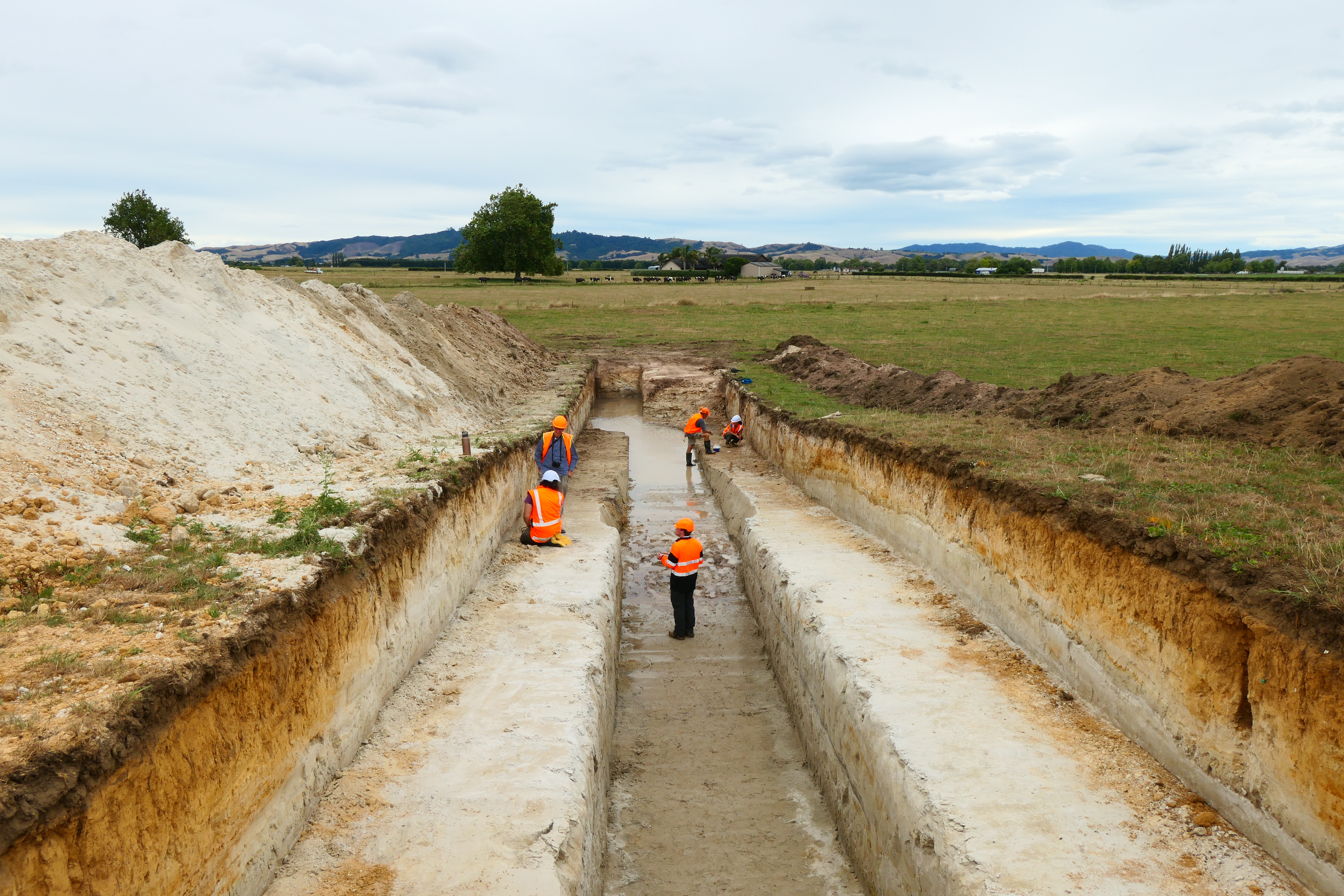
The purpose of this research was to investigate the potential size and frequency of earthquakes on a newly discovered fault in a region of low seismicity. Due to the availability of LiDAR, the Te Puninga Fault on the Hauraki Plains near Morrinsville (Waikato) was found to be independent of the nearby Kerepehi Fault.
“By digging trenches across the 25 km stretch of the Te Puninga Fault and studying the exposed soil layers displaced in previous earthquakes over the past 20,000 years, we have been able to determine that this fault has the potential to generate large earthquakes up to M w 6.7 every 3,000–11,500 years. Though rare, our research suggests these events can result in very strong shaking for the Hauraki Plains and nearby Hamilton.
“We believe this research will improve our seismic hazard modelling that indicates the probable frequency, shaking intensity and impacts that earthquakes on this fault may have on the Waikato and surrounding communities. Understanding the seismic potential of the Te Puninga Fault is vitally important for preparing communities for large earthquakes, particularly those in areas of low
seismicity who may be unfamiliar with the disruptive and unsettling impacts of large seismic events.”
Professor David Lowe, School of Science, University of Waikato
The research on the Te Puninga fault has been essential for a closely related but separate project researching newly-discovered hidden faults in the Hamilton lowlands. Professor David Lowe and his team, funded by Marsden and MBIE and working closely with GNS Science and others, have been using the liquefaction of volcanic-ash layers preserved in lakes in the lowlands as a new way to work out a history of earthquake activity since around 20,000 years ago.
“Our results so far indicate that the Te Puninga Fault was likely responsible for at least one episode of earthquake shaking that impacted the Hamilton lowlands. The event caused ash-layer liquefaction in the lakes in the northern Hamilton lowlands. Other earthquakes detected using the ash liquefaction method were likely caused by movements on the Hamilton lowland faults. Nothing was known previously about prehistoric earthquakes in the Hamilton area. These findings are of benefit for seismic hazard modelling in the Hamilton area, which are currently in progress.
“The work on Te Puninga fault had an additional benefit in that radiocarbon dates from the trench sites allowed us to date the age of the land surface in that part of the Hauraki Plains. These dates show us that the dramatic switch in direction (called an avulsion) of the flow-path of the ancestral Waikato River into the Hamilton lowlands, which previously flowed through the Hauraki Plains area
to the Pacific Ocean, took place around 24,000 years ago, consistent with new dates obtained the entry of the river into the Hamilton lowlands.”
Attachments
Note: Not all attachments are visible to the general public. Research URLs will go live after the embargo ends.


