
 Australia; VIC; QLD; SA
Expert Reaction
These comments have been collated by the Science Media Centre to provide a variety of expert perspectives on this issue. Feel free to use these quotes in your stories. Views expressed are the personal opinions of the experts named. They do not represent the views of the SMC or any other organisation unless specifically stated.
Dr Ariel Liebman is Deputy Director of the Monash Energy Materials and Systems Institute (MEMSI) at Monash University
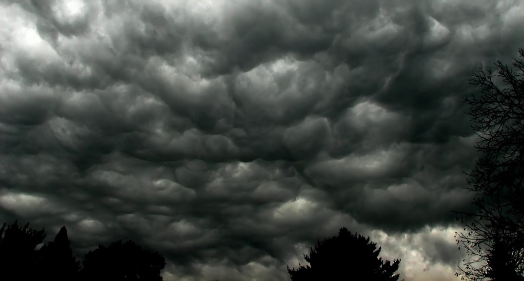
The current severe weather event in SA and in Adelaide have led to large scale blackouts. Can this and other blackouts, including the state-wide blackout on the 28th of September 2016, be attributed to how renewable energy sources interact with severe weather systems?
The answer is no! The outages seen in 2016 and the one yesterday are not surprising given the severity of the weather experienced by SA recently and the relative sparseness of the state’s generation and transmission network.
The most recent set of outages last night that occurred solely within the lower voltage distribution network and affected 66,000 customers is quite severe but not unprecedented given the extreme weather experienced (including 112 km/h winds and 74,000 lightning strikes in 2 hours!).
This is not particular to SA - Queensland regularly experiences outages of this kind in its distribution networks and in 2003 this got so bad that a government review was held resulting in increased investment in the distribution network to attempt to remedy the risk of outages.
The reason Australia experiences more of these types of outages than the US and Europe is that our distribution networks are almost completely above ground and exposed to the elements.
Without undergrounding the entire distribution grid at a prohibitive cost, the risk of outage cannot be mitigated with traditional electrical engineering approaches. The only hope is for distributed energy sources to be combined with battery storage and operated and coordinated appropriately. The CSIRO and Energy Networks Australia’s Energy Networks Transformation Roadmap discusses this very well (http://www.energynetworks.com.au/electricity-network-transformation-roadmap)
The large-scale outage in September 2016 is a completely different phenomenon related to the high voltage transmission and generation systems’ intrinsic fragility when faced with a large-scale disturbance such as the tornados that took out 20 or more transmission towers.
Combined with SA’s relatively skinny transmission network (designed to trade-off cost and reliability to support the state’s large size and relatively small population) such a blackout was highly likely and the system was brought back on-line remarkably fast, a credit to AEMO, Electranet and SA Power Networks. This sort of blackout can occur with zero renewable generation as evidenced by the USA’s 2003 North Eastern blackout that affected 55 million people, or the 2006 blackout in Europe affecting 15 million people. Both at the time had negligible amounts of renewable energy!
To conclude, these outages are a natural consequence of the severe weather patterns currently experienced and of the design of electricity distribution and transmission networks, which has remained largely unchanged since the 1920s.
Currently, levels of renewables penetration, even in South Australia, do not yet have a bearing on system reliability. However, this issue is emerging as a very important one and is beginning to be addressed. For example, in the Chief Scientist Alan Finkel’s current review and significant analysis and research is required to determine the optimal design of the system as we move towards a high renewables future.

Matt Collopy is Supervising Meteorologist for South Australia at the Bureau of Meteorology
Tropical air mass over SA saw thunderstorms developing over Eyre Peninsula moving over Adelaide in the evening.
As the system moved across, this produced large thunderstorms, damaging wind gusts, heavy rain and high rainfall rates in isolated areas.
This resulted in some locations reporting their wettest January day on record, and month-to-date totals have already resulted in some locations having their wettest January in more than 20 years.
Already, most locations across agricultural South Australia have reported more than twice the long term January average rainfall.
Rainfall:
Maynard's Well 70.4mm
Leigh Creek 61.2mm
Auburn 51mm
Little Para Reservoir 49mm
Edinburgh 44.8mm (notably at Edinburgh 24mm fell in 25 minutes in the evening yesterday)
Wilpena 106 mm
Buckleboo 76 mm
Wind Gusts:
Adelaide Airport 111km/h @ 20:27
Warburto Point 111km/h @ 19:12
Wudinna 106/km/h
Minlaton 100km/h @16:30
70.4 mm at Maynards Well to 9am this morning and 61.2 mm at Leigh Creek are both highest daily rainfall totals at these sites since March 2012.
51.4 mm at Blinman is highest daily rainfall since Jan 2015. At Auburn also with 51.4 mm, was highest since Feb 2014.
Edinburgh with 44.8 mm had 70mm in late Dec 2016. 27mm of this in 1 hour is about a 1 in 15 year ARI (average recurrence interval) for that location.
Port Augusta recorded 10.6 mm in 9 minutes, which has an ARI of ~1 in 5 year.
Ian Lowe is Emeritus professor of science, technology and society at Griffith University, Qld and former President of the Australian Conservation Foundation.
As climate science was predicting nearly thirty years ago, the increasing average temperatures are causing changes to rainfall patterns. The more intense tropical rain depressions crossing the north-west coast of WA are tracking south-east across the country, bringing storms and heavy rain to areas that have previously been dry in summer: eastern WA, central Australia, SA, western NSW and western Victoria.
The interruptions to power supply in SA have been the direct result of intense storm activity. Queensland has always had intense summer storm activity, so their system has learned to cope with these events; nevertheless, it is common for significant areas of Queensland to lose power briefly during severe storms.
Increasing the fraction of electricity supplied by distributed sources (solar panels, local wind turbines) reduces dependence on long high-voltage lines and reduces the risk of losing power when severe weather strikes. So encouraging more use of renewables both improves local supply security and slows the global processes which are causing the problem.