
 International
News release
From:
Insights into Utopia basin revealed by Mars rover
A new radar image from the Zhurong Mars rover that provides insights into the surface structure of the Utopia Planitia basin is presented in Nature. The findings — which reveal multiple sub-layers suggestive of sediment deposition following episodic flooding millions of years ago — may improve our understanding of the planets’ geological and hydrological history.
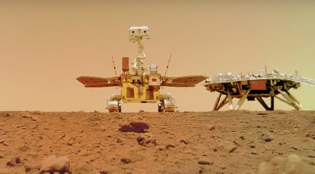
Utopia is an impact crater on Mars that is widely believed to have hosted an ancient ocean, making it a key target for exploration. However, we haven’t had any new ground-based data from this region for 45 years, since the Viking-2 rover mission. In 2021, the Zhurong rover successfully landed on Mars, as part of China’s first mission to the Red Planet. Zhurong has since been traversing the Martian landscape, with the aim of providing further insight into Utopia’s surface.
Ling Chen and colleagues present an image of the surface of southern Utopia Planitia constructed from ground-penetrating radar data collected by Zhurong as it travelled approximately 1,117 metres from its landing site. The image reveals that the ground of the Utopia basin is segmented into multiple sub-surface layers, approximately 70 metres thick in total. On the surface lies a layer of regolith (loose rock and dust) less than 10 metres thick. Although the authors caution that alternative models need to be investigated, they state that the layered structure may indicate that the basin experienced episodic flooding during the Late Hesperian to Amazonian period.
The authors conclude by highlighting that although radar data from Zhurong alone did not provide direct evidence for the presence of liquid water in the upper 80 metres of the basin surface, its presence at lower depths cannot yet be ruled out.
Attachments
Note: Not all attachments are visible to the general public. Research URLs will go live after the embargo ends.


