Australia; NSW; QLD

Media release
From:
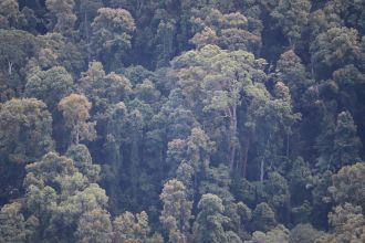
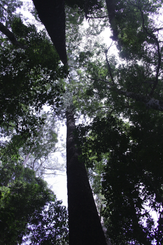
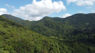
Game changing new research has measured individual tree heights across 3.1 million hectares in the New South Wales Northern Rivers Region, revealing a level of detail not captured before including old growth forests and the tallest tree at 81 metres.
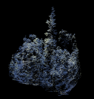
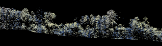
In the study published today in Australian Journal of Botany, advanced mapping techniques using LiDAR and computational power have revealed a detailed assessment of forest structure at the single-tree level over large geographic extents of the Northern Rivers region. LiDAR (Light Detection and Ranging) uses laser light to measure distances to create detailed three-dimensional (3D) models of the landscape, including trees.
Lead author on the National Environmental Science Program Resilient Landscapes Hub project, Dr Patrick Norman from Griffith University said the advanced mapping techniques allowed them to use publicly available Airborne Laser Scanning data to model forest canopy height and individual trees across a 3.1 million hectares, at a level of detail that has not been achievable until now.
“This has allowed us to map the forest canopy in incredible detail capturing more than 180 million individual trees across this huge area,” Dr Norman said. “We have been able to identify the tallest trees, including an 81 metre flooded gum (Eucalyptus grandis)and a 77 metre hoop pine (Araucaria cunninghamiiI. This has also allowed us to understand a better picture of where the remaining areas of old growth forest are, which will be important for conservation efforts.”
The analysis of tree heights across different vegetation types and land uses showed the tallest trees were found in wet sclerophyll forests, in areas of native forest designated for nature conservation or timber production.
“This information provides valuable insights into the influence of environmental and human impacts on tree heights, which could be used to inform management strategies and conservation efforts within the region and can also be applied to other forested landscapes,” Dr Norman said.
This research is part of a project to develop climate change adaptation plans for the Northern Rivers region of New South Wales and the Wet Tropics of Queensland. Both regions are home to many threatened species and ecological communities and contain a diverse range of land uses and protected areas, including significant wetlands, national parks, World Heritage Areas, Indigenous Protected Areas and Indigenous Land Use Agreements. They are also places of rapid change: in a three-year period in the Northern Rivers region, unprecedented drought has been followed by bushfires and floods in rapid succession.
Images available here
The National Environmental Science Program Resilient Landscapes Hub is funded by the Australian government to provide research to inform management of Australia’s terrestrial and freshwater habitats to promote resilience and sustainability.
Multimedia