
 Australia; Pacific; NSW; VIC; QLD
News release
From:
Expert Reaction
These comments have been collated by the Science Media Centre to provide a variety of expert perspectives on this issue. Feel free to use these quotes in your stories. Views expressed are the personal opinions of the experts named. They do not represent the views of the SMC or any other organisation unless specifically stated.
Dr Tom Mortlock is Head of Climate Analytics Asia-Pacific at Aon, and Adjunct Fellow in the Climate Change Research Centre at UNSW
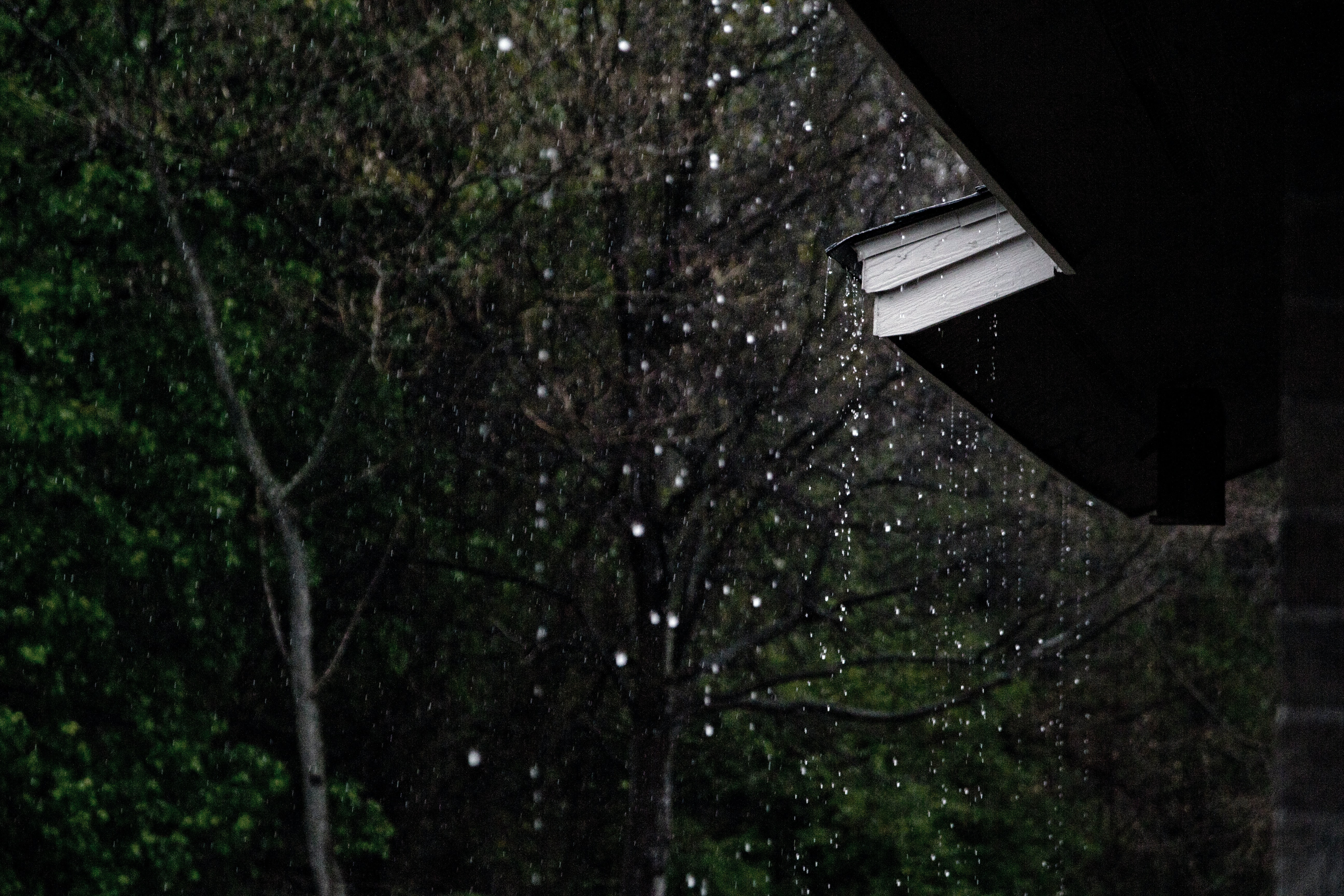
For the third year in a row, we are officially in La Niña. Triple dip La Niñas are relatively rare - this has only happened three times before since records began in Australia – from 1954 to 1957, 1973 to 1976, and 1998 to 2001. What is even more uncommon is that we are now into our second consecutive negative IOD (Indian Ocean Dipole), which is unprecedented in the historical record. Both La Niña and negative IOD spell a wetter than usual spring and summer for the east coast, although both are forecast to break down towards the start of the New Year.
While the BoM has only just declared La Niña, many other international weather bureaus have been saying we’ve already been in La Niña for a few weeks. And while the focus is on “triple-dip”, this La Niña is forecast to be a much weaker version of last year’s event. The concern, however, is that river catchments and dams all along the east coast are already full, and so it doesn’t need much more additional rain to cause surface water and river flooding. We also know from the historical loss record, that flood and cyclone losses along the east coast are significantly correlated with periods of La Niña.

Professor Paula Jarzabkowski is a Professor of Strategic Management at the University of Queensland
This third La Niña, if it brings extreme flooding, will devastate people who are still not back in homes flooded in February and March this year, many of whom are still awaiting insurance claims to be settled, or have not been able to begin reconstruction. These people will slide into further inequality as they are unable to count on future resale, insurability, or even ability to cover their existing mortgages on their homes. The costs will not be confined to those at risk of flood, but will affect all Australians.
Over the past 12 months, extreme weather has cost every Australian household an average of $1,532. We can expect this figure to rise. This third La Niña shows that we must act now on mitigation and managed retreat from areas that are no longer viable for Australians to live.
Professor Mark Howden is Director of the Australian National University Institute for Climate, Energy and Disaster Solutions
"The ocean and atmospheric conditions of a La Nina have been evident for several months and a La Nina has been identified by other climate service organisations accordingly. The value of seasonal climate forecasts is significantly increased when they are made early.
La Nina conditions shift the probability towards above average spring and summer rainfall. Whilst this may increase the likelihood of floods, particularly as soil profiles and dams are currently largely full of water, it also tends to increase agricultural productivity and recharge river systems and aquifers. These effects of a La Nina may be enhanced over the coming months because of the conditions in the Indian Ocean which also point towards higher than average rainfall.
Historically, La Nina conditions tend to bring cyclone tracks closer to the east Australian coast and further south than they would usually occur, bringing increased risk of cyclone damage."
Adjunct Professor Mark Gibbs is a specialist in coastal engineering and management, coastal climate adaption and risk assessment at the Queensland University of Technology and Australian Institute of Marine Science
As expected, the Bureau has declared a further La Niña event. This is not good news for communities, businesses, homeowners, and renters who are living or operating out of buildings and dwellings that are at risk from inundation. This may be particularly problematic for those that are still recovering from recent floods, especially in light of the present challenges in securing the services of builders and building suppliers.
It is an early and timely reminder for all to get storm-prepared, pull out your flood emergency plan, and think about how to respond if the waters begin to encroach. Major floods often occur later in the storm season (after Christmas), and this can lead to a false sense of security if flooding has not occurred before Christmas.
Dr Shayne McGregor is an Associate Professor (Climate) at Monash University in the School of Earth, Atmosphere and Environment
A declared La Nina event means that most of Australia can expect a wetter than normal spring, with the exception being in the South West. Looking to summer (October to March), an ongoing La Nina event would increase the chance of extreme rainfall occurring over much of the east coast. Moving into the Tropical Cyclone season ( November-April) an ongoing La Nina event means an increased chance of tropical cyclone landfall in the North as they tend to form closer to Australia's coastal regions.
This is the fourth time we have had three La Nina events in a row since 1950. However, given that in this time we have only had about 13 La Nina events, counting the current event, about 30% of La Nina events are triple dip events. Meaning that these are not that rare.
Given the increased rainfall that occurs during La Nina events, including an increase in Summer extreme rainfall, we would expect to see an increase in flood risk over summer across much of Eastern Australia. We would also expect this to lead to a decrease in the chance of bushfires. But we do note that ENSO is not the only factor that influences extreme rainfall and bushfires, so there is still a chance that we end up having a normal rainfall and a normal bushfire season.
In terms of the agricultural impacts of this La Nina event, an increase in rainfall can often be a good thing for agriculture if it is spread over months to seasons. However, high precipitation amounts that occur over short periods (which is often referred to as extreme precipitation) can be very detrimental.
Dr Kimberley Reid is an atmospheric scientist from the ARC Centre of Excellence for 21st Century Weather at the University of Melbourne
I would bet my bottom dollar that there will be more flooding in eastern Australia in the next six months. The climate patterns in the Pacific, Indian and Southern Oceans are all pointing to a wet spring. Since the rivers and dams are already full, any significant rainfall will likely lead to floods.
Three La Niña events in a row, called a triple-dip La Niña, have happened before during 1973-76 and 1998-01. Our understanding of how often this occurs is limited by the lack of historical observations over the ocean. There is not enough data to robustly evaluate trends in La Niña when we only have observations back to the 1950s.
Dr Adrian McCallum is a Senior Lecturer in Science & Engineering at the University of the Sunshine Coast
So, the indicators suggest that another La Niña is apparent; what does this mean for Australians?
Well, for us on the east coast, it suggests another wet ending to the year, with above-average rainfall probable…
Looking at the Bureau’s ENSO Outlook data, it looks like we had La Niña events at the end of both 2010 & 2011, and in 2007 & 2008, but, a period where conditions have been sustained for three years is not evident from their Outlook data, that commences in 1980.
Looking more broadly at the Bureau data that documents La Niña occurrences, events that span portions of three years are evident (2010-12, 2007-9, etc.) but three La Niña events in three years (impacting three springs/summers) is not evident in the data presented from 1902 onwards, except for the period June 1973 until March 1976, when "rainfall was above average over virtually the entire country” and a period of 34 months, from April 1954 until January 1957.
So, it looks like flooding could occur again, bushfires may be suppressed due to the expected wet weather (but perhaps may increase in the future due to increased growth) and we might struggle to harvest and transport crops, if the expected wet weather remains…
Associate Professor Iftekhar Ahmed is from the School of Architecture and Built Environment at University of Newcastle
Different climate models have been providing warning of another La Niña peak with above average rainfall in eastern Australia during this year’s spring. However, the models are not able to predict with certainty whether the above-average rainfall would actually result in floods; if the rainfall is spread out during an extended duration, there might only be small-scale localised floods, which is within the community’s management capacity.
On the other hand, recent trends indicate high-intensity rainfall events over short durations, which have led to the recent flood disasters in eastern Australia. There is thus a cause for trepidation – NSW has already been battered by a series of floods this year and also in 2021. Since the recent floods in July 2022, many people are still in temporary accommodation and have barely begun their recovery, so at this time another flood would have devastating consequences; if the same places as before are impacted, it might set back any gains made in the recovery process.
On the positive side, this early warning allows better preparedness, and most emergency management agencies have gained iterative lessons over the recent successive floods. Therefore, there is reason to expect a better response and management experience if there are indeed further floods this spring.
Milton Speer is a Visiting Fellow in the School of Mathematical and Physical Sciences at the University of Technology Sydney
I guess it was expected. If it is a strong La Nina like last spring/summer then it could be bad news for somewhere in eastern Australia (not necessarily Lismore). Most dams are full along the western slopes of NSW and southeast QLD so if the rain concentrates inland in those places it’s bad news. Having said that, not all La Ninas produce extreme rainfall, especially if they are classified as weak to moderate.
Andrea Taschetto is an Associate Professor at the Climate Change Research Centre UNSW and ARC Centre of Excellence for Climate Extremes.
The Australian Bureau of Meteorology has moved its ENSO outlook status from La Niña Alert to La Niña. The atmospheric circulation in the equatorial Pacific has strengthened in the past weeks, so it is no surprise that La Niña has been declared.
La Niña and El Niño appear every 3 to 7 years, generally in an alternate way. But sometimes a second La Niña can manifest after a La Niña event in the tropical Pacific. These double-dip La Niña are not uncommon; about half of the La Niña events that occurred since 1950 were double-dip La Niña events. However, triple La Niña events are quite rare in the historical record. Triple La Niña occurred only twice since 1950 (1973-76 and 1998-2001); some agencies would say three times, depending on the index based.
But the fact is that we are now experiencing a rare event again. And given that east Australia received above average rain with some areas suffering from floods this year and the last, a third La Niña and the wet outlook for spring do not seem the best news for those regions.
Dr Lurion De Mello is a Senior Lecturer in Applied Finance at the Macquarie University Business School
It is not very common to have three La Niña events in a row. While we cannot dismiss torrential rain over the coming months the chances of severe flooding are small for eastern parts of Australia. However, the flood plain areas in NSW should be under “elevated risk” over summer.
With higher chances of rain, bushfire risk will remain low in NSW and QLD. If Tasmania experiences very dry conditions over summer the risk of fires is likely to increase. The additional rain over the past two years has resulted in lush growth in traditional bushfire risk areas.
Over the past two years, Australian coal exports were impacted due to extensive rainfall. Coal has to be in a reasonable dry state to be mined and exported. Supply of fresh produce has started to come back online. Further heavy rainfall is likely to disrupt supply chains. Some consumers are just starting to pay under $3 for lettuce. The price of tomatoes still remains elevated. Moderate rainfall in NSW is likely to benefit wheat, canola and barley crops over spring and summer.
Dr Margaret Cook is a lecturer in history at the University of the Sunshine Coast
A triple La Niña has only happened three other times in the past 120 years since national rainfalls were first collected. The concern with three successive La Niña years is the increased likelihood of flood at a time when the region’s dams are largely full and rivers high. With a soaked catchment, the runoff rate will be extremely high.
Rainfall records tumbled in Queensland and New South Wales this year, with some places recording flood peaks not seen in more than 100 years. The sheer scale and intensity of the natural disaster that swamped South-East Queensland and New South Wales caught many by surprise.
The latest predictions of more extreme weather could be triggering for some. With floods so close together it is also easy to feel flood fatigue, a weariness to coping with disasters which erodes our ability to cope.
As weather patterns continue to change and urban development creates more impermeable surfaces that alters runoff, it becomes increasingly difficult to predict what might be in store. The big question is, what are we doing to prepare?
As a community, we could be mobilising volunteers to help prepare. We need a flood army beforehand, rather than relying on the mud army afterwards to clean up the mess.
Dr Kathy Townsend is an Associate Professor in Marine Science at University of the Sunshine Coast (USC)
Recent reports of mass marine turtles deaths on the beaches of K’gari Fraser Island and Rainbow Beach are of no surprise. We predicted this would happen. Marine reptiles are struggling to find food. Hundreds of turtles are in danger of starving to death in the coming months.
It is only going to get worse, even without the prospect of more extreme rainfall and possible flooding. The cause is sediment washed out from rivers and creeks from months of unusually heavy rainfall and flooding earlier this year that has smothered seagrass meadows, taking away the primary food source of turtles and dugongs.
In some areas, such as the Fraser Coast, only one per cent of seagrass beds remain. If we have another season like this one, it is not going to be good. Expect more starving turtles. And more dugong strandings also.
Dr Javier Leon is a geographer at the University of the Sunshine Coast
The most recent extreme weather events have taken their toll on many beaches and dunes along Australia’s eastern coastline. There is considerable erosion. For example, we’ve observed that between Coolum and Sunshine Beach on Queensland’s Sunshine Coast, the dunes have eroded landwards by 15-20 metres and up to 3 metres in height.
This has happened without major storms or cyclones. The chances of significant cyclones and storms are higher for the forecasted conditions this upcoming season. In the worst case, we can expect levels of erosion similar to 1974 when conditions were similar with three back-to-back La Niña events.
On a positive note, dune vegetation has grown with the rains so that might offer some additional protection to some areas. A key learning from the recent floods is that our climate is supercharged by heating and that, literally, when it rains it pours. We have to be ready and prepared for worst-case scenarios. Research is a critical element in steps to mitigate the impact of coastal erosion from a changing climate.
Dr Aaron Tham is a Lecturer in Tourism, Leisure and Event Management at the University of the Sunshine Coast
The pent-up demand following three summers of disruption will likely witness individuals and groups seeking to make travel plans where possible in advance to take advantage of early bird bookings and not risk destinations being booked out.
Those who are navigating the unpredictability of La Nina in Australia may decide instead to travel to international destinations that are perhaps not as adversely impacted by such volatile summer seasons.
On Destination Insights with Google, searches for travel keywords by Queensland users between April and July 2022 revealed a 75% increase in searches for South-East Asian destinations like Indonesia, Singapore and Thailand.
The La Nina effect is going to require Australia’s tourism operators to be dynamic in terms of their offerings, working very closely with other stakeholders to deliver the quality products and experiences that we are best known for.
Some tourism operators whose businesses were swamped by flood waters earlier this year are still waiting to rebuild or have closed their doors.
The significant floods that occurred in February and April this year have resulted in numerous insurance claims from tourism operators in regions like Gympie – many of whom have waited six months or more for their payout.
Dr Rachael Sharman is a Senior Lecturer in Psychology at University of the Sunshine Coast
What we know less of is the psychological impact of these repeated disasters. There is not a lot of research on that repeated trauma, but you can guarantee that it is going to be worse. And that’s a problem.
Apart from the obvious stress of having your home or business flooded, it really is the disorientation that really hits people afterwards.
When disasters happen in quick succession, it is much more than just clean-up and keep-calm and carry-on. It is a much bigger question than just how do I get through this one trauma. It can be life-changing. What is my future now? Can I go on living here?
The one that comes up trumps in terms of people actually getting through things such as floods and other disasters, and feeling better about it, is what we call problem-solving coping.
My advice is to really break down what the problem is and what you need to do to mitigate it," says Dr Sharman. "This gives people a much better sense of control over their environment, which relates to much lower levels of stress.
It really is throwing yourself into practical solutions to problems or finding ways to minimise the damage that might occur.
Attachments
Note: Not all attachments are visible to the general public. Research URLs will go live after the embargo ends.

