
 Australia; NSW; VIC
Expert Reaction
These comments have been collated by the Science Media Centre to provide a variety of expert perspectives on this issue. Feel free to use these quotes in your stories. Views expressed are the personal opinions of the experts named. They do not represent the views of the SMC or any other organisation unless specifically stated.
Dr Bill McGuire is a Professor of Geophysical & Climate Hazards at the University College London
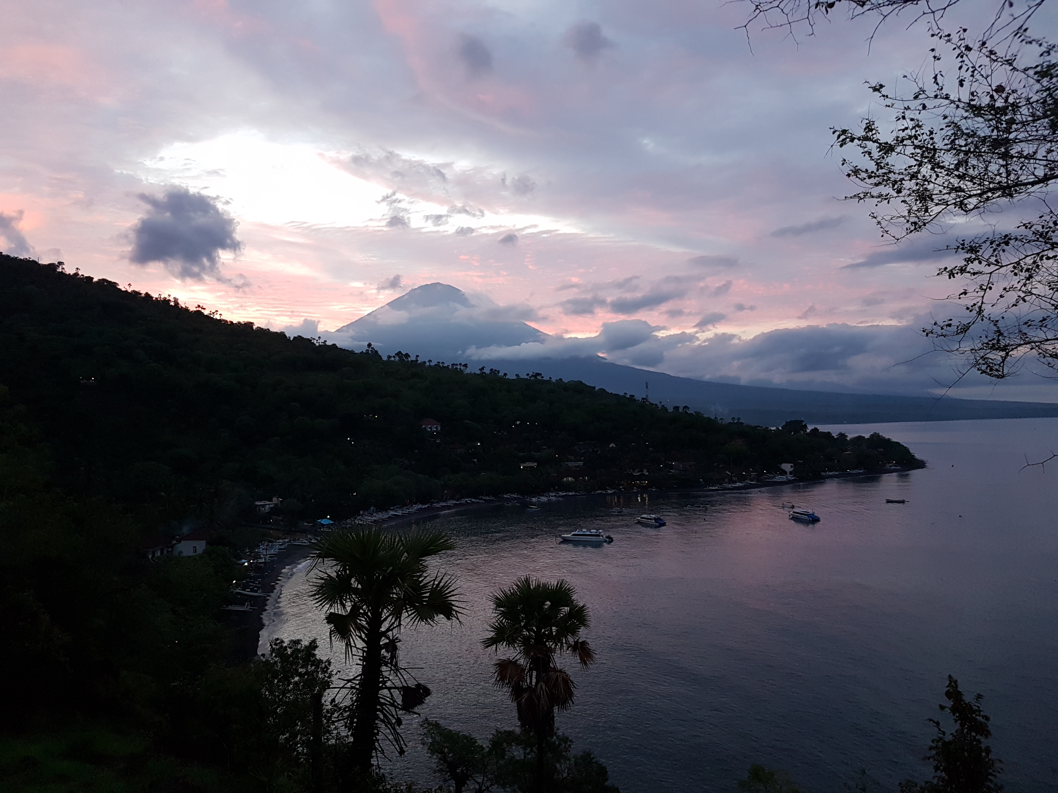
Mount Agung is well known amongst volcanologists as a volcano capable of pretty hefty eruptions.
The last major blast in 1963 not only took more than a 1200 lives, but also had a measurable cooling impact on the global climate.
With more than half a century on, this renewal of activity does not come as a surprise, and could end with a significant and potentially lethal eruption.

Emeritus Professor Ray Cas is from Monash University and an expert in volcanoes
Mt Agung volcano is a very large strato-volcano that is over 3000 m high and located in Northeast Bali. It experiences a major explosive eruption (> VEI 4) about once every century. The last eruption occurred in 1963-1964 with the death toll of about 1500. That eruption was multifaceted including the eruption of lavas, a large volume of widely dispersed volcanic ash, and the formation of fast flowing, hot, pyroclastic flows of ash, gas and rock debris, which killed the most people. In addition, because of the height and steep sides of the volcano, volcanic mudflows also formed causing significant loss of life. The current crisis of earthquakes under the volcano and increased gas release from the crater suggests to Indonesian volcanologists that an eruption is imminent. Many of the earthquakes are volcanic earthquakes related to the rise of molten rock or magma inside the volcano, and because these are becoming shallower Indonesian authorities consider the likelihood of an eruption occurring to be significant. This has led to the evacuation of the population within a 12 km radius of the volcano. It is not possible to predict exactly what the style of the eruption will be if it occurs, but if it is of the magnitude and the scope of the 1963-64 eruption, then this will be a major one with many primary and secondary volcanic hazards. Whether or not air traffic into Dempasar airport will be affected by an eruption of Agung volcano will depend on the wind direction at the time of the eruption, which controls the direction of dispersal of airborne ash.
Dr Heather Handley is Volcanologist and Associate Professor at the University of Twente and Adjunct Associate Professor at Monash University
There has been a significant increase in recent days of volcanic earthquakes (those caused by magma movement and gas bubble formation) below the volcano. The location of the earthquakes has changed over time, becoming shallower and suggesting that magma is moving closer to the surface and an eruption may be imminent.
‘Seismic crisis’ is not always followed by a volcanic eruption but the number and depth of volcanic earthquakes in recent days at Agung have not been witnessed since the previous eruption and have caused the alert level to be raised to its highest level ‘awas’ or ‘danger’ and trigger the evacuation of those living closest.
The last two eruptions of Mount Agung in 1843 and 1963 had a Volcanic Explosivity Index (VEI) of 5, on a scale where 0 would be something like a lava flow on Hawaii that you could generally walk or run away from, and 8 would be a supervolcanic eruption like Yellowstone (USA) or Toba (Indonesia).
If Mount Agung erupts and the eruption is similar to its two previous large-scale eruptions then we might expect to see:
- Lava flows reach several kms from the summit, in any direction.
- Deadly pyroclastic flows (hot, fast moving clouds of gas, ash and rock fragments) travel tens of kms from the summit, which may travel a greater distance down river valleys.
- Significant amounts of erupted volcanic ash (tiny <2 mm, pulverised, jagged fragments of volcanic glass, rock fragments and minerals) that may make the sky turn dark, we might expect the roof collapse of houses close to the summit where the ash fall is thickest (it was 40-70 cm thick from the last two eruptions within approx. 10 km from the summit) and fine ash to rain down further away depending on how high the ash is erupted and the wind direction at the time.
Due to the high level of sulphur dioxide in magma erupted at Agung, if this mixes with water vapour in the atmosphere it can create sulphuric acid and so acid rain could be an issue. These sulphur aerosols can last several years in the stratosphere (if the eruption column is more than 10 kms high) and block incoming solar radiation, leading to longer-term (months-years) global temperature effects.
After the activity ends, we could continue to see hazards from 'lahars', an Indonesian term for a debris flows created when rain or any other source of water mixes with the loose volcanic deposits. These are extremely hazardous as they are like flowing wet concrete and can get more voluminous as they travel.
Emile Jansons is the Bureau of Meteorology's En Route Aviation Services Manager
The Australian Bureau of Meteorology's Darwin Volcanic Ash Advisory Centre is the regional centre of expertise in volcanic cloud monitoring. We are in continuous contact with Indonesian colleagues and with the aviation industry as we monitor Mount Agung for any signs of an eruption.
We receive observations from volcano observatories, pilots and updated satellite imagery every 10 minutes. Should Mount Agung erupt, we will monitor the volcanic ash clouds, forecast their movement, liaise with Indonesia, the aviation industry, and other countries to ensure that aircraft are aware of any potential for encountering volcanic ash in flight.
Dr David Boutelier is a Senior Lecturer in the School of Environmental and Life Sciences at the University of Newcastle
Mount Agung or Gunung Agung is a stratovolcano in Bali in Indonesia. Stratovolcanoes are characterized by periodic explosive and effusive eruptions. The principal dangers associated with stratovolcanoes are, by order of increasing risk: debris projected up to 10 km in the air, lava flows travelling 10’s of km in few weeks, cold lahars which are devastating mudflow or debris flow caused by heavy rainfall on unconsolidated pyroclastic deposits (ashes), and pyroclastic flows which are catastrophic, very fast moving flows (700 km/h) of hot gas and volcanic matter (1000C).
Multimedia
Attachments
Note: Not all attachments are visible to the general public. Research URLs will go live after the embargo ends.

