New Zealand; Pacific
Expert Reaction
These comments have been collated by the Science Media Centre to provide a variety of expert perspectives on this issue. Feel free to use these quotes in your stories. Views expressed are the personal opinions of the experts named. They do not represent the views of the SMC or any other organisation unless specifically stated.
Dr Kari Bassett, Senior Lecturer in the School of Earth and Environment at the University of Canterbury, comments:
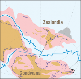
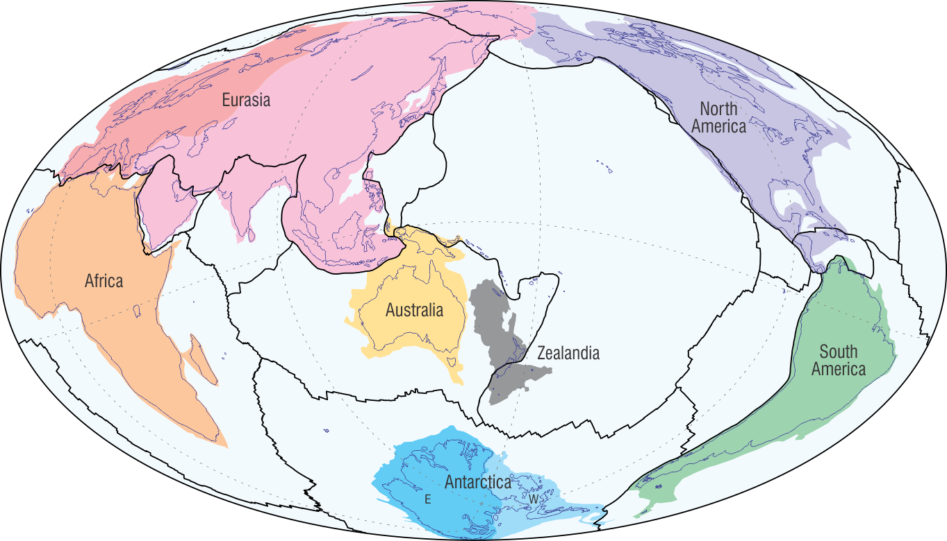
This paper is a thorough review of Zealandia or Te Riu-a-Māui, the term applied to the whole
of Aotearoa New Zealand including the extensive under water plateaus.
"Zealandia’s history, recorded in the rocks beneath our feet, starts with the supercontinent Gondwana where the early land of Zealandia was located near Antarctica and Australia. Zealandia formed along the ancient supercontinent’s southern margin in a volcanic mountainous setting similar to the Andes Mountains of today. As Gondwana broke apart, the growth of the Tasman Sea and the Southern Ocean separated Zealandia from Antarctica and Australia about 100 million years ago.
"Once its own landmass, Zealandia developed a unique flora and fauna as it became mostly submarine plateaus. The continent that we see today started developing about 25 million years ago with a volcanic zone in the North Island and the mountains of the Southern Alps shaping our dynamic landscape.

Dr Nick Mortimer, Emeritus Geologist at GNS Science and the author of this review, comments:
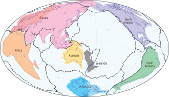
This is the most comprehensive review yet of the geology of the five million square kilometre, 95% submerged, Zealandia continent.
"For most of the past 500 million years, Zealandia was part of the southern supercontinent of Gondwana. Then, 85 to 60 million years ago, Zealandia split from Gondwana to become its own continent. Since its maximum drowning 25 million years ago, movements at plate boundaries have built up the North and South Islands.
"I've had a four-decade research career, and it's only recently that we have gathered much of the evidence defining Zealandia as a continent—in part thanks to new tools like satellite and marine geological data. While I hope this review will be a useful reference for at least the next decade, there are more discoveries to come. We've answered a lot of the 'what, when and how' questions but many 'whys' are still unknown, such as "Why did the Gondwana supercontinent break up?" and "Why are there so many extinct volcanoes scattered across Zealandia?"
James Crampton, Professor of Paleontology and Stratigraphy, Te Herenga Waka Victoria University of Wellington
In Google Earth, centre the image on Mo’orea in French Polynesia: the vast Pacific Ocean fills the view. The only significant landmass visible is Aotearoa / New Zealand – the emergent 5% of the otherwise submerged continent of Te Riu-a-Māui / Zealandia. Notwithstanding incredibly valuable drill core and oceanic island samples, it is Zealandia that represents our largest source of material samples relating to the tectonic, oceanographic, climatic and biologic development of the Pacific hemisphere.
Zealandia’s stratigraphic archive records the history of planet-driving ocean-climate systems and of unique plants and animals – Aotearoa’s living taonga. Importantly, Zealandian strata document the causes and regional impacts of perturbations on the Earth system – natural experiments that reveal the responses of our life, oceans and climate to disturbances of varied scale, cause and rate. The geological record of Zealandia is a globally critical piece in the Earth system puzzle.
The paper by Mortimer is a succinct but rich and beautifully illustrated summary of everything we know about our continent. There is so much more to learn; it is the responsibility of New Zealand scientists to unveil our piece of the Earth system puzzle and place it into the global context; this task is urgent.
Multimedia