
 Australia; New Zealand; Pacific; International
News release
From:
Geoscience: Coastal sea levels may be higher than previously thought *PRESS BRIEFING* *VIDEO*
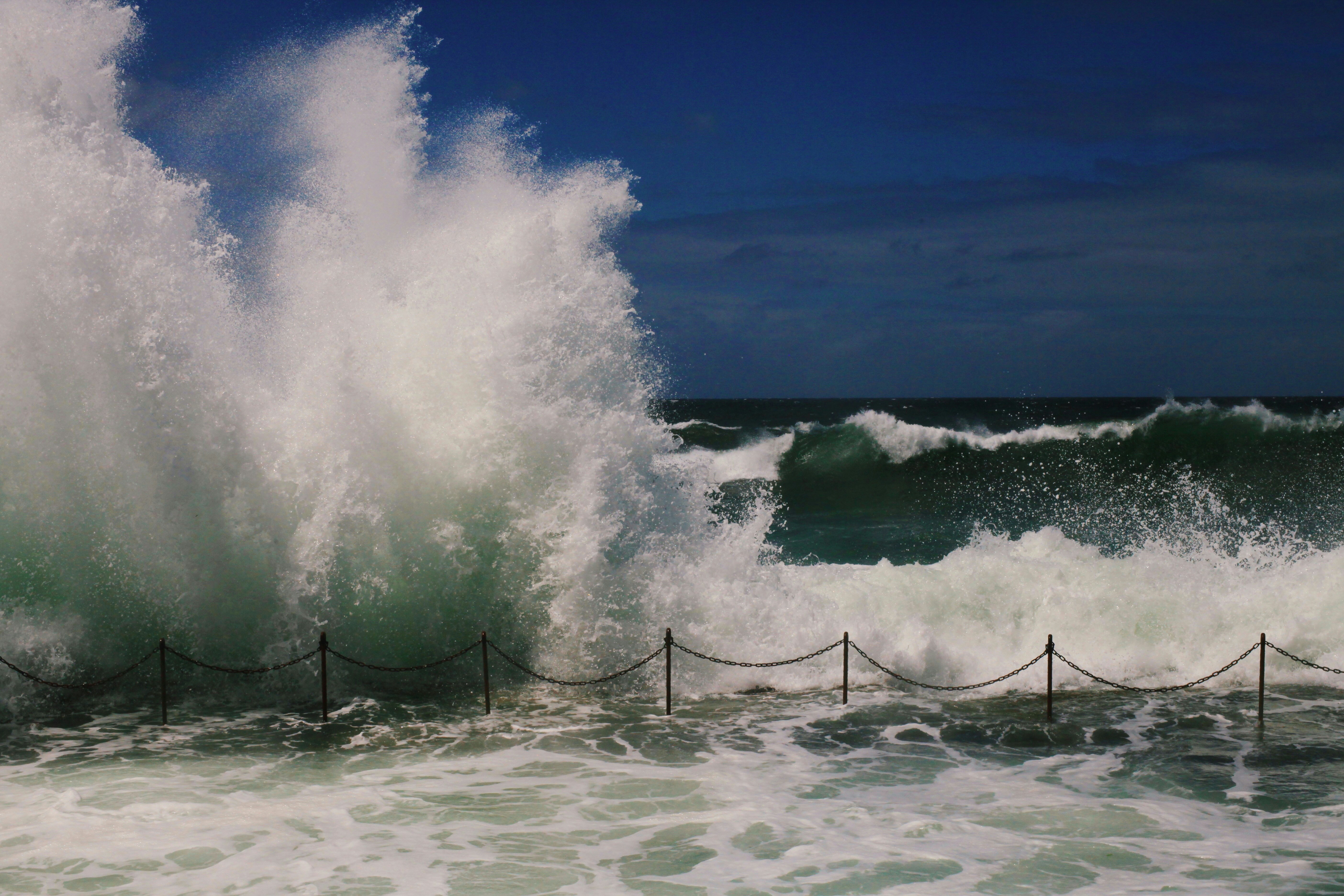
Most research may have underestimated coastal sea-level height across the world by an average of 0.3 m, according to a study published in Nature. In some areas in the Global South, these levels may be up to 1 m higher than previously assumed. The findings highlight the need to re-evaluate existing values and ensure that future coastal hazard assessments correctly combine sea-level measurements with coastal elevation for a better understanding of how climate change is impacting coastal areas.
Sea-level rise is a major threat to coastal communities, and the Intergovernmental Panel on Climate Change estimates that ocean levels may increase by between 0.28 and 1 m by 2100. However, impact assessments of coastal sea-level rise across the globe often assume sea-level rather than considering local, direct measurements of sea-level height.
Katharina Seeger and Philip Minderhoud analysed 385 pieces of peer-reviewed scientific literature on coastal exposure and hazard impact assessments, published between 2009 and 2025, and performed worldwide meta-analyses to calculate the difference between commonly assumed and actual measured coastal sea level. They found that more than 90% of all studies relied on assumed sea levels based on gravitational models, so-called geoids, rather than using measured sea level. As a result, sea level was underrepresented by 0.24 to 0.27 m depending on the geoid model used, with some discrepancies being as high as 5.5 to 7.6 m. Thus, sea-level rise and other coastal hazard impact assessments were calculated using a coastal sea level that is, on average, lower than the true actual sea level, consequently underestimating coastal exposure. These underestimations were particularly noteworthy in the Global South — specifically in Southeast Asia and the Pacific Region. Underestimates were also observed in Latin America, the west coast of North America, the Caribbean, Africa, the Middle East, and the Indo-Pacific. They note that these issues are the result of the assumption that Earth gravitational models provide an acceptable estimate of local sea-level around the world. However, these models only account for gravity and Earth rotation and do not account for other factors that determine local sea level, such as tides, current, and winds. Through meta-analyses of the most common assumptions found in the published literature and by properly combining coastal elevation to measured sea-level height data, the authors found that compared with previous estimates a hypothetical 1 m of sea-level rise could put up to 37% more land below sea level, impacting 77–132 million people across the globe.
The authors conclude that re-evaluation of the methodology of existing assessments for characterizing sea-level rise impact is needed, with possible implications for policymakers, climate finance and coastal adaptation plans.
Expert Reaction
These comments have been collated by the Science Media Centre to provide a variety of expert perspectives on this issue. Feel free to use these quotes in your stories. Views expressed are the personal opinions of the experts named. They do not represent the views of the SMC or any other organisation unless specifically stated.
Gabriel Mara, Pacific Adaptation and Loss and Damage Analyst, Climate Analytics
“This paper finds something quite concerning; many of the projections have underestimated both what we are currently measuring and what we are likely to experience in the future. For Small Island Developing States (SIDS), that is far from a discrepancy. Because if the projections are conservative, then the policies, infrastructure standards and adaptation plans built on those projections are conservative also. And in our (SIDS) context, conservative does not mean safe. It means SIDS are further behind then currently believed.
“This is serious for Pacific SIDS: as parts of the western tropical and southwest Pacific have historically experienced rates of sea-level rise above the global average due to ocean dynamics. Sea level is not uniform, it shifts with currents, heat and gravity. So while globally the numbers can look one way, locally the lived experience is very different.
“The paper notes (in fig. 4) that compared to other regions, the Pacific shows lower exposure in aggregate terms. But we have to interrogate what “lower exposure” means. If exposure is measured by total population or absolute land area, then yes, small islands will appear smaller in the dataset. But proportionally? Existentially? Losing 1% of land in a large continental country is not the same as losing 1% of a small island state. In our context, that 1% could be an entire village or half a town, a burial ground, a freshwater lens and livelihood for subsistence survival.
“And this is where the implications move past adaptation planning. If projections and threshold triggers are too low, adaptation becomes reactive rather than anticipatory. You build a seawall for yesterday’s sea level. This brings soft and hard limits much earlier, compressing the window between ‘adaptable’ and ‘unavoidable loss’. This leaves residual risk higher than planners assume as countries will face greater losses than projected because hazard baselines are underestimated.
“Even with the levels and projections that are considered standard references, Pacific communities are already facing the impacts of sea-level rise. Right now, coastal erosion and saltwater intrusion is actively occurring in the Pacific. Sacred sites are already being relocated. People are already forced to leave their ancestral lands.
“If sea-level rise is happening faster than what is currently thought, then losses including non-economic losses are also happening faster than our planning and anticipatory frameworks assume or are equipped for. Non-economic loss and damage is rising quietly alongside the water, unavoidable losses will accumulate sooner and at greater scale. That directly affects discussions around Loss and Damage finance, responsibility and equity.
“While the study does not directly assess whether the underestimated projections feed into IPCC assessments, it does highlight something important. Many national policies rely heavily on frequently referenced sources like the IPCC as the global scientific benchmark. If the studies it uses are conservative and synthesise the same into reports, the true description of what the reality is has been severely limited as the panel operates on assessment cycles.
“For SIDS, that suggests we need to read the science carefully, especially like that of the Small Islands chapter, and ask whether we are planning for the median, or for the reality experienced on the ground.
“Can SIDS and coastal states only plan for the median of current models, or can they be aided to prepare for what is increasingly observable in front of them?”

Dr Emma Ryan, Senior Lecturer in Environmental Science at the University of Auckland
"This study is a welcome addition to global sea‑level rise research. Many worldwide assessments rely on coarse resolution global satellite data. By using a more accurate and globally-consistent way of measuring coastal land elevation, the authors show that earlier global studies may have underestimated how many places are exposed to future sea‑level rise. This is an important improvement in our global understanding.
"However, global studies can only take us so far. They are not designed for local planning or decision‑making. While they can highlight global and regional differences, the impacts of sea level rise on coasts vary a lot from place to place, depending on factors like land sinking or rising (vertical land motion, often caused by tectonic factors), sediment movement, storm patterns, waves, and long‑term shoreline change patterns.
"For Aotearoa New Zealand and Pacific Island nations, high‑quality local data remains essential. New Zealand and Pacific Island nations need more investment in obtaining and maintaining accurate elevation datasets for both the coastal zone and the nearshore. New Zealand is already investing in high-quality local data. The New Zealand Coastal Change Database (coastalchange.nz) provides long‑term, nationally consistent coastal erosion rates that can be used to underpin local or regional coastal hazard and risk assessments.
"Other national research programmes are updating localised sea‑level rise projections with vertical land movement data, which will give communities more accurate information for regional and local planning. New Zealand and Pacific Island nations should prioritise local data for decision making about sea-level impacts."
Dr. Dalila Gharbaoui, Political and Social scientist, Adjunct Research Fellow, University of Canterbury
Professor Silvia Serrao-Neumann, Environmental Planning, The University of Waikato
"My quick read of the paper indicates that it won't affect Aotearoa as much because it focuses on the implications for the Global South, especially low-lying coastal areas in Southeast-Asia. Aotearoa has the Searise portal which accounts for the vertical land movement cited in the paper as one of the critical errors. In summary, we don't lack the information on the impacts of sea level rise on our coasts. Our impediment is more of a political nature, as in being more proactive in decisions to avoid further developing coastal areas at-risk of sea level rise and related coastal hazards such as erosion and inundation."
Multimedia
Attachments
Note: Not all attachments are visible to the general public. Research URLs will go live after the embargo ends.

